

Digital Twin Sim is a telecommunications business and network modeling advisory firm that uses high-resolution aerial imagery and data to create accurate simulations of mobile networks. Digital Twin Sim has worked with a number of high-profile telecommunications companies to plan and deploy the 5G networks of tomorrow.
Planning complex, low-tolerance mobile networks
The arrival of fifth-generation wireless technology promises unprecedented advances in mobile broadband. Lightning-fast mobile data speeds, increased network capacity and a new avenue to expand broadband coverage across the U.S. However, realizing the benefits of 5G demands a whole new level of complexity and precision when it comes to planning mobile networks. For instance, telecommunications firms that want to roll out 5G need to account for line-of-sight — a straight, unobstructed path — between cell towers, requiring time-consuming and costly on-site survey work.
High-resolution geospatial data powers precision network modelling
With more than 25 years of experience in telecommunications network planning, Digital Twin Sim co-founder Sameer Lalwani explains that there’s an easier way to make 5G a reality: simulation.
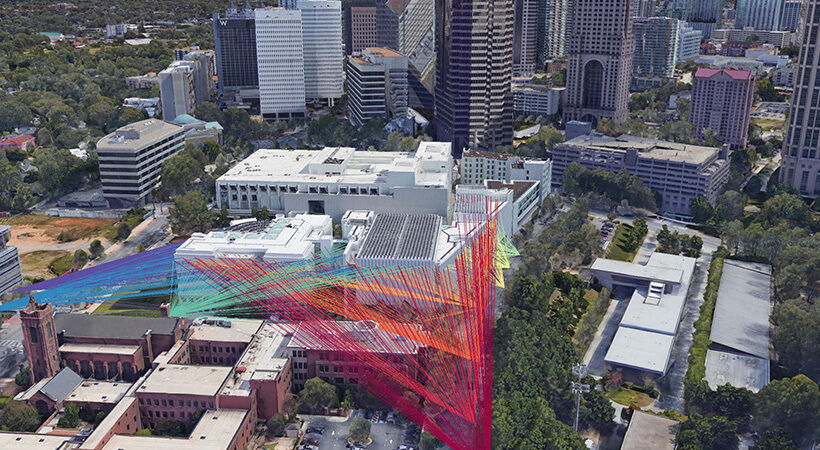
Recently, using Nearmap’s up-to-date, high-resolution geospatial data, Digital Twin Sim created an accurate “digital twin” of a US city for a major telecommunications company, down to every last bush, branch, and car. Digital Twin Sim then used powerful cloud computing services to simulate ideal network equipment placement. With 6-inch digital surface model resolution, Digital Twin Sim was able to verify line-of-sight between network towers, project coverage maps, and measure performance.
“When you have data at this resolution and at this scale, there are lots of very interesting things you can do in terms of network planning,” says Lalwani. “If you’re planning a link that’s 6 miles long and a branch comes in somewhere and obstructs it by 4 to 6 inches, you can see that happening in the simulation.”
Accelerating 5G expansion at a fraction of the cost
Although early 5G pilot networks have been successfully deployed using traditional real-world survey methods, telecommunications companies face major challenges in terms of scale. Through manual surveys, it would take several days and cost thousands of dollars to plot out a single node in a 5G network. Using Nearmap imagery and geospatial data, Digital Twin Sim simulated thousands of nodes in an afternoon at a fraction of the cost.
What’s more, Digital Twin Sim used a Nearmap-powered digital model to continually verify network performance. With high-resolution imagery that’s updated frequently, Lalwani identified small obstructions, like tree branches, across an entire citywide network in minutes — something that otherwise might take a week using current methods.
When it comes to the value of simulating 5G network models versus traditional real-world planning, Lalwani is unequivocal: “I don’t think 5G expansion would be practical without simulating. It almost seems unthinkable to do all of this manually.”